

Gallery

This street scene is the 200 block of East Angeleno in 1982. Note businesses in this picture include the Holiday Inn, Samuel's Restaurant, and Alamo Club.

This street scene is the 200 block of North San Fernando, showing a rear parking lot next to Pep Boys.

This street scene features residences on the 300 block of North Hollywood Way in 1940s or 1950s.

This is the Scribner Crane House at 425 Palm, which is considered a sister to the Mentzer House.

This residence at 516 S Mariposa is a home with stables.

This is the residence at 525 S Bel Aire.

This residence at 639 East Palm Avenue was the home of Arthur W. Reese.

This picture of the residence at 703 S. Glenwood is dated March 23, 1965.

This picture of the residence at 907 E. Olive was taken in 1922. The house is similar to its neighbor, the Rock House, which was a designated a historical resource.

This picture of the residence at 1705 Grismer is dated August 7, 1974.

This is the 1924 Burroughs basketball team.

This 1950 residence has a 743 address but the street is unknown.
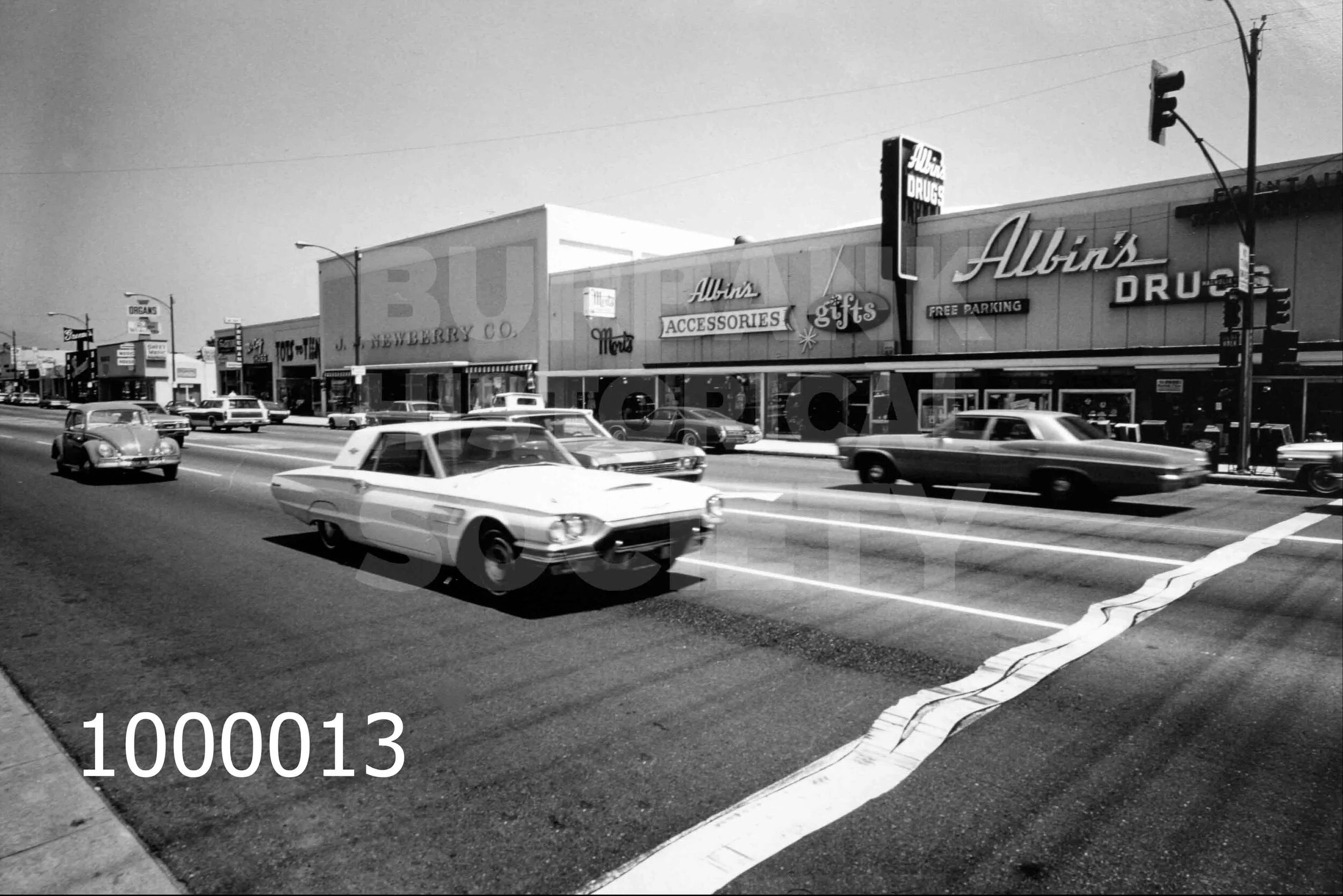
This is a street scene at 3600 Magnolia Blvd in the 1960s. Noted businesses include JJ Newberry Co., Mort's, and Albin's.

This is the A.C. Fillbach Funeral Home which was established in 1919. This photo was taken in the mid 1930s.

This is Airway Alley also known as Airway Lanes bowling alley.

This is the Andrew Jergens Co. at 99 W. Verdugo. This photo was taken in 1927.

This picture shows the interior of Acme Market in 1920.

This is another view of the Andrew Jergens Co. at 99 W. Verdugo. This photo was taken in 1936.

This is Fawkes Folly, an early monorail or aerial trolley made by the Aerial Trolley Car Co. Inc. Its patentees were LW & EC Fawkes. The original photo is on file with UC Berkeley and is part of the William C. Barry Collection of Los Angelea Area Photographs.

Another view of Fawkes Folly, an early monorail or aerial trolley built by the Aerial Trolley Car Co. Inc. The trolley is shown here running through a Burbank orchard.

Aerial view of Burbank High School

Aerial view shows Army Air Corps planes flying over United Airport. Photo taken by Schlick Photo.

Auto shop. May be a business or in a high school. Photo undated.

In this 1935 aerial view you can see Union Air Terminal, Crawford Ranch, 3G Distillery, Washington School, and McClure Winery.

This aerial view was taken from the Verdugo Hills in 1908.

This is a 1920s aerial view of Lockheed and its factory site.
This is an aerial view of Cahuenga in 1951.

In this 1939 aerial view you can see the air terminal and Brusso Winery in the lower right corner.

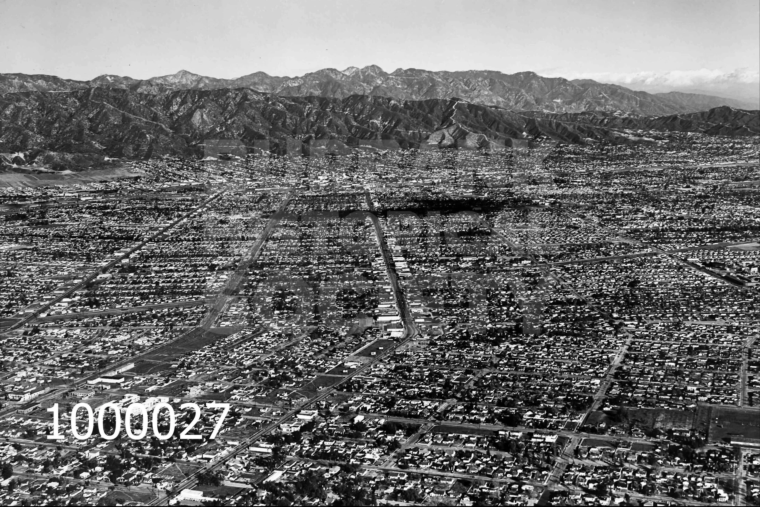
This is an aerial view of Burbank taken January 21 1957.

This aerial view from 1928 features Burbank and Magnolia.

This 1947 aerial view of Burbank Blvd at San Fernando features the a high school and junior high, the Southern Pacific railroad tracks and Lockheed. In the background or at the top of the picture is Lockheed Building 199.

This is a 1930s aerial view near San Fernando Road, Empire Ave and Victory Place. Lockheed and the Empire China Company are featured.

This is an aerial view of Sunset Canyon in 1927.

This 1947 aerial view features Glenoaks Park, which is later known as McCambridge Park, Veteran's temporary housing, and KWIK radio tower. The streets shown include San Fernando Blvd., Scott Road, Broadway, and Leland Way.

This is a 1940s aerial view of Hollywood Way and Vanowen.

Another aircraft accident where the crash occurred in a residential area.

Aerial view of John Burroughs High School on Verdugo.

This aerial view, taken from 14K feet is dated August 24, 1945. It shows the Lockheed air terminal and factory.

This 1940s aerial view shows the Union Air Terminal and Lockheed Buildings 68, 69, and 74. Also shown here are hangers originally built in the 1930s.

This 1930s aerial view features downtown Burbank, specifically Olive to Santa Anita, and San Fernando to Fifth Street.

This 1920s aerial view looks toward the Hollywood Hills.

This 1924 aerial view is another look towards the Hollywood Hills.

This 1930s aerial view shows the Union Air Terminal with nearby farms and Valhalla near bottom of the shot.

This is a 1935 aerial view of the Union Air Terminal.

This is an aerial view of the airport, Valhalla and surroundings.

Aircraft accident on Jan. 21, 1956. The plane crashed near Eton Drive and Richard Street killing the pilot.

Aircraft accident.

Another aircraft accident where the crash occurred in a residential area.

3G Whiskey Distillery

This Lockheed Model 10 Electra was sold and flown by National Airlines. Featured here is one used for its Buccaneer Route.